



Learn how to measure property boundary length using digital maps, GPS, and parcel records. Discover how to calculate property perimeter, find boundary dimensions, and understand when a professional land survey is needed.
Planning a fence, buying land, or checking the size of your backyard often starts with one question: where does your property end? Learning how to measure property lines on a map can help you estimate boundary lengths without walking the entire parcel.
Online parcel maps, GPS tools, and distance calculators make it easier to study property dimensions. You can measure individual sides, estimate total perimeter, and compare the results with existing land records.
However, digital maps do not always show exact legal boundaries. Knowing where to find reliable property information is just as important as understanding how the measurements work.
How to Measure Property Lines on a Map
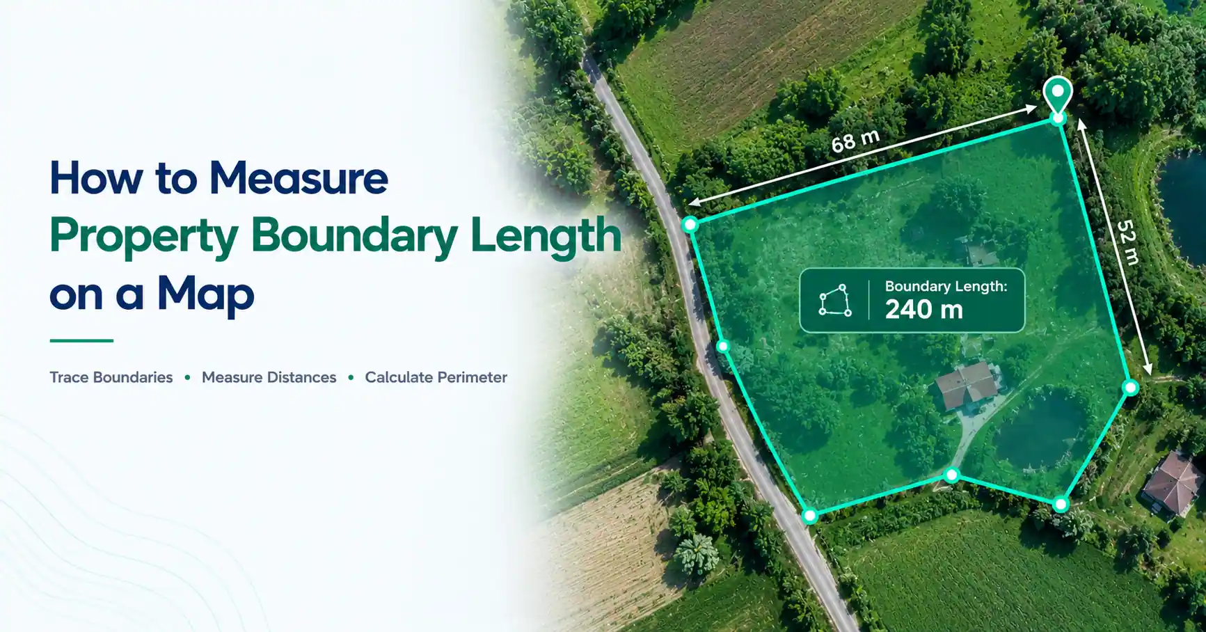
To measure property lines on a map, locate your parcel, identify its boundary corners, and use a distance measurement tool to measure each side. Add the individual lengths to estimate the total perimeter. County parcel viewers and recorded surveys can help identify boundaries, but map-based measurements should not replace a legal boundary survey.
For a useful estimate, start with the best available parcel information. A clearly marked boundary makes it easier to place measurement points accurately.
What Is Property Boundary Length?
Property boundary length refers to the distance along a property line. A parcel usually has several boundary segments that connect at corners.
The total distance around the property is called its perimeter. Property area is different because it measures the space enclosed by those boundaries.
Frontage is another related term. It usually refers to the portion of a property facing a road or another specified feature.
Two properties can contain the same acreage but have different perimeters. A long, narrow parcel often has more boundary length than a compact square parcel of equal area.
How to Measure Property Boundaries on a Digital Map
Digital mapping tools can help estimate boundary lengths once you have identified the intended parcel lines.
If you're learning how to measure property boundaries, follow these steps:
Search for the property using its address or parcel identification number.
Open a county parcel viewer or a suitable digital mapping tool.
Identify the parcel outline and approximate corner locations.
Compare the displayed lines with available surveys or property records.
Select a distance measurement tool and mark the first boundary segment.
Continue measuring each connected side around the property.
Record the lengths and add them to estimate the total perimeter.
Compare your result with recorded dimensions when available.
For irregular properties, you may need additional points along angled or curved boundaries.
This approach is useful for understanding how to measure land boundary length before planning a fence, driveway, or landscaping project.
Remember that the result depends on the accuracy of both the boundary information and your selected points.
How to Calculate Property Perimeter
Property perimeter is the combined length of every side surrounding a parcel.
For a rectangular property, use the formula Perimeter = 2 × (Length + Width).
Suppose a residential lot is 100 feet wide and 150 feet deep. Its total perimeter is 500 feet because the two shorter sides total 200 feet and the longer sides total 300 feet.
For an irregular parcel, add the measured length of each individual boundary segment instead.
Understanding how to calculate property perimeter is useful when estimating fencing materials or comparing lot dimensions.
The same method explains how to calculate perimeter of land with several sides. Unlike area, perimeter is expressed in linear units such as feet or meters.
How to Measure Irregular Property Boundaries
Irregular properties may have angled corners, unequal sides, or curved boundaries. These shapes cannot always be measured using only length and width.
When learning how to measure land perimeter, follow the actual boundary rather than drawing a simple rectangle around the property.
For example, a five-sided parcel needs measurements for all five boundary segments. A curved boundary may require several closely spaced points to estimate its length.
Adding more points along bends can improve a map-based approximation. However, the result still depends on the quality of the source map.
For properties with complex boundaries, an existing survey may provide more reliable dimensions than a manually drawn outline.
Can You Measure Property Lines Using Google Maps?
Google Maps can measure distances between selected points, but it does not generally provide verified legal property boundaries.
To understand how to measure land distance on a map, you can use Google Maps' Measure distance feature.
On a computer, right-click a starting location and select Measure distance. Click another point to display the distance. Additional points can create connected segments around a parcel.
The difficulty is identifying where the legal property corners actually lie.
Satellite imagery may show fences, roads, or landscaping features, but these do not necessarily follow ownership boundaries.
Use recorded parcel information to identify the intended lines before making measurements.
How to Measure Property Lines Using GPS
GPS-enabled mapping apps can help estimate distances while you are outdoors.
A common approach is to identify approximate boundary corners, record their coordinates, and measure the distance between neighboring points.
Some GPS apps can also track movement along an accessible route, which may help estimate the length of a visible fence or path.
However, learning how to measure property lines using GPS also means understanding positioning errors.
Trees, buildings, terrain, and device limitations can affect readings. A smartphone GPS location should not be treated as a legally established boundary marker.
For precise property corners, professional surveying methods are more appropriate.
Where Can You Find Property Lines and Dimensions for Free?
Many counties provide online parcel maps through GIS viewers or assessor websites. These resources may show parcel outlines, identification numbers, addresses, and basic property information.
Some areas also provide access to recorded subdivision plats, deeds, and survey documents.
A county parcel viewer is often a useful starting point because it helps connect an address with the relevant property record.
However, not every county offers free online access. Some records require payment or a visit to the appropriate office.
If you need exact property dimensions, look for a recorded survey or subdivision plat. When those documents are missing or unclear, a licensed surveyor may be needed.
What Does 200 Feet of Property Frontage Mean?
A property with 200 feet of frontage generally has 200 feet along the road or other feature used to define its frontage.
Frontage does not describe the property's total perimeter or depth.
For example, a rectangular property with 200 feet of road frontage and 300 feet of depth has a total perimeter of 1,000 feet.
Frontage measurements matter when considering driveway access, building placement, and certain local development rules.
The official method for measuring frontage may depend on local requirements, especially for corner lots or properties along curved roads.
How Accurate Are Property Boundary Measurements on Maps?
Map-based measurements can be useful for planning, but their accuracy varies.
A parcel outline may not align perfectly with satellite imagery. Older records, map adjustments, and differences between data sources can also affect where a boundary appears.
Small errors in corner placement can change the measured length of a property line.
Curved boundaries create another challenge because connecting only a few points may underestimate their actual length.
For preliminary estimates, digital tools are convenient. For exact boundary positions, a qualified surveyor can review legal records, physical evidence, and field measurements.
What Is the Best App for Finding Property Lines?
The best tool depends on what you need to measure.
County GIS viewers are often useful for locating parcel records and viewing approximate boundaries. GPS mapping apps can help with outdoor positioning, while distance calculators help measure lengths between selected map points.
A property line distance calculator is useful when you already know which points to measure. It does not independently establish the legal boundary between properties.
For general property boundary measurement, start with official parcel records and choose a mapping tool that fits your task.
For legal verification, use a professional survey.
Property Line Setbacks and Ownership Limits
Property lines can also affect where structures may be built and how landowners use their property.
How Far Must a Building Be From a Property Line?
The required distance is called a setback. Setbacks vary depending on local zoning rules, building codes, the type of structure, and applicable easements.
There is no single setback distance that applies to every property.
Before building near a boundary, check the requirements with your local planning or building authority.
How Far Up Do Property Lines Go?
Property ownership can include rights involving usable airspace above the land, but those rights are not unlimited.
Air navigation laws, easements, and other legal restrictions can affect how that space is used.
Underground rights can also differ from surface ownership, particularly where mineral rights are separately held.
Common Mistakes When Measuring Property Boundaries
One common mistake is assuming an existing fence marks the exact legal boundary. Fences may have been installed inside or outside the surveyed property line.
Another mistake is relying entirely on satellite imagery. A visible hedge, wall, or driveway does not prove ownership.
People also sometimes confuse perimeter with area or forget to include shorter boundary segments.
Using inconsistent measurement units can create errors as well. Keep all segment lengths in feet or meters before adding them.
Finally, avoid treating consumer GPS readings or online parcel outlines as certified boundary evidence.
When Should You Hire a Land Surveyor?
A professional land survey may be needed when property boundaries affect legal rights or expensive decisions.
Common situations include installing fences near disputed lines, building close to neighboring land, dividing property, or purchasing a parcel with unclear boundaries.
Surveyors review records, existing monuments, and field evidence to determine boundary positions.
Their work can help resolve differences between online maps and recorded property information.
For basic planning, map measurements may be enough. For legal boundary decisions, a survey provides a more reliable foundation.
Final Thoughts
Knowing how to measure property lines on a map can help you estimate boundary lengths and understand property dimensions.
Start with reliable parcel information, measure each boundary segment, and add the distances to find the total perimeter. Remember that frontage, perimeter, and area describe different parts of a property.
Digital maps and GPS tools are useful for preliminary estimates. When a boundary must be legally verified, rely on recorded evidence and professional surveying.
Frequently Asked Questions
Check existing surveys, recorded subdivision plats, deeds, and local land records. These may contain boundary dimensions. If the records are incomplete or unclear, a licensed land surveyor can help determine the property's legal boundaries.
Some county GIS viewers and assessor websites display parcel boundaries without charging a fee. However, these lines may be approximate. Availability differs by location, and official survey documents may require payment.
Google Maps can display locations and measure distances, but it does not reliably identify verified legal property lines. Use official parcel maps or recorded surveys to locate boundaries before measuring them.
A professional boundary survey is generally the most reliable method. A qualified surveyor examines legal descriptions, recorded documents, existing boundary markers, and field evidence to determine the proper boundary positions.
It generally means a property has 200 feet along the road or another feature used to define frontage. This measurement does not describe the entire perimeter or the depth of the property.
Building setbacks depend on local zoning, building codes, easements, and the proposed structure. There is no universal required distance. Check with the local planning or building authority before starting construction near a property boundary.