
Map Area Calculator – Measure Plot and Field Area Online
Measure fields, plots, farms, and properties quickly with a GPS-powered map area calculator. Draw boundaries on an interactive map or use location-based measurement to calculate land area for agriculture, surveying, construction, landscaping, and property planning.
FieldCalc helps farmers, surveyors, contractors, and property professionals measure land with GPS.
43.5M+
Areas Measured

29M+
Users Worldwide

How to Use the Map Area Calculator
A google maps area calculator works by allowing users to select points on a map and calculate the enclosed area. It helps estimate land size without manually measuring the entire property.
Open the map and find your required location.
Mark points around the boundary of the field, plot, or property.
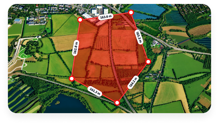
Adjust points to match the land shape.
Complete the boundary to calculate the total area.
Select your preferred unit, such as acres, hectares, square feet, or square meters.
Features and Benefits
Get fast map-based measurements, simple boundary marking, and useful area results for different land-use needs

GPS-Based Area Measurement
Use GPS technology to measure land areas directly from your location. This is useful for farmers and field professionals working on large properties.

Interactive Map Measurement
The area calculator map allows you to draw boundaries directly on a map and view results instantly. You can measure fields, gardens, yards, and land plots easily.

Irregular Shape Support
Land boundaries are often uneven. Add multiple points to measure complex areas such as farms, construction sites, and open spaces.

Multiple Unit Conversion
View results in acres, hectares, square feet, and square meters. This makes the tool useful for different industries and regions.

Quick Planning
A land area calculator google maps users can use helps with project estimates, fencing plans, property checks, and land management.
Uses of Map Area Calculator
Measure land, fields, plots, and property boundaries directly on the map for quick area estimation.

Agriculture and Farming
Farmers can calculate field size, estimate acreage, plan irrigation layouts, and manage farmland more effectively.

Land Surveying
Surveyors can use a google map area calculator for initial site checks and measurement planning before detailed surveys.

Construction Projects
Contractors can measure site areas, review available space, and support early project planning.

Real Estate
Property owners and agents can measure plots, yards, and boundaries when evaluating land.
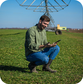






Start measuring fields, plots and properties with ease using GPS technology.
How Area Calculation Works
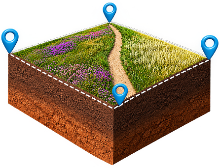
The calculator measures the enclosed map boundary and converts it into an estimated area using the selected points.
A google maps area calculator tool uses points placed around a boundary to calculate the enclosed area. The system uses location coordinates to estimate the total land size.
Accuracy depends on GPS quality, map data, device performance, and how carefully points are placed. For legal property measurements, professional surveying methods should be used.
Reviews and User Feedback
Users value the tool for its simple interface, quick measurements, and practical use for land and field calculations.

Ramesh Patel
Farmer, GreenField Farms
Easy way to measure farm areas and check land size before planning work.

Brian Carter
Property Consultant, Prime Properties
Helpful for quick property measurements during site visits.

Jason Miller
Land Surveyor, GeoMap Solutions
Really useful for measuring land areas quickly and keeping the results for later.

Suresh Desai
Land Surveyor, GeoMap Solutions
I can measure my farm area in just a few taps. So simple and convenient!
Suresh Desai
Land Surveyor, GeoMap Solutions
I can measure my farm area in just a few taps. So simple and convenient!
Ramesh Patel
Farmer, GreenField Farms
Easy way to measure farm areas and check land size before planning work.
Brian Carter
Property Consultant, Prime Properties
Helpful for quick property measurements during site visits.
Frequently Asked Questions
A Map Area Calculator is a tool that helps you measure land area, fields, plots, and properties by marking boundaries on a map and calculating the total area.
To measure land area on a map, select points around the boundary of your property or field. The calculator uses these points to estimate the total area and display the result.
Yes, GPS map area calculators are useful for farming, surveying, property measurement, and outdoor projects where accurate land size calculations are needed.
A map area calculator can typically measure land area in units such as square meters, acres, hectares, and other commonly used area measurements.
Need to measure something else?
Try our other online tools for distance, radius, and coordinate measurements.