



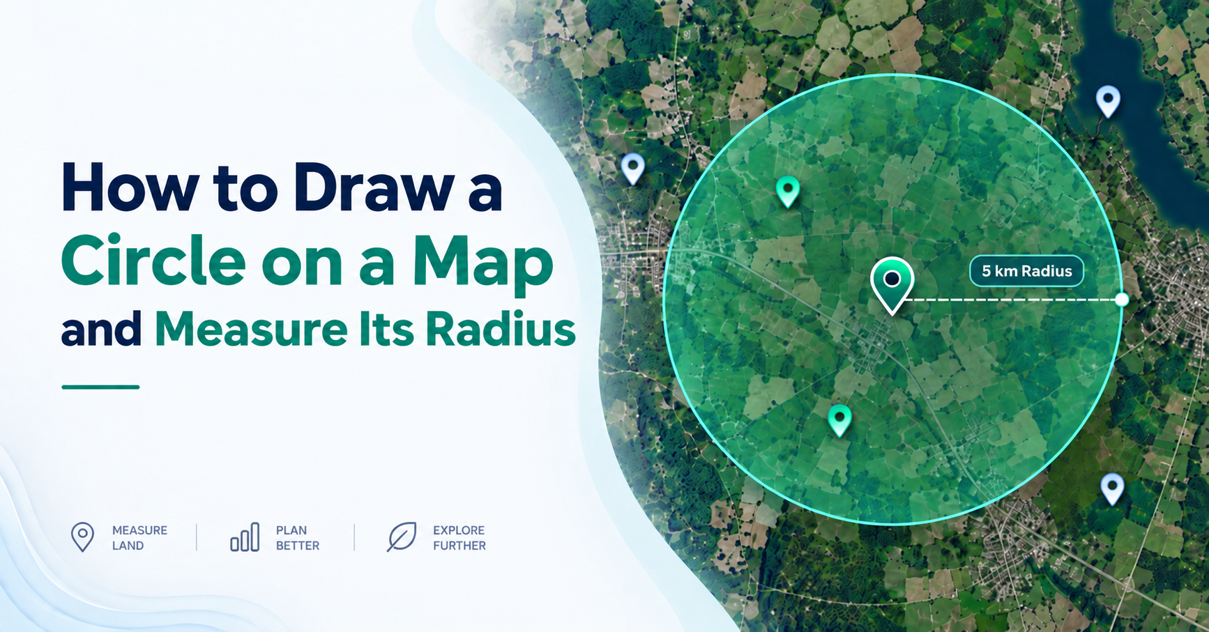
Learn how to draw a circle on a map, measure its radius, understand Google Maps limits, and use radius circles for land, travel, and planning.
You need to know what sits within 5 km of your shop. Or which homes fall inside a school's catchment area. A straight line won't answer that. A circle will. This guide shows you how to draw a circle on a map, how to get one onto Google Maps, and how to measure the radius once it's there.
What Is a Radius Circle on a Map?
A radius circle is a shape drawn on a map that covers every point within a set distance of one centre point. The distance from the centre to the edge is the radius. It measures straight-line distance, not road distance. A 5 km radius includes everything 5 km or closer, in every direction.
People call straight-line distance "as the crow flies". The crow ignores roads, rivers and traffic lights. It just flies over them.
Driving distance is almost always longer. A house 3 km away as the crow flies can be a 7 km drive if a river sits between you. When you draw a circle with a radius on a map, you're fixing one point and one distance. Nothing else.
Can You Draw a Radius Circle on Google Maps?
Yes, but not with Google Maps on its own. Google Maps has no circle button. Google My Maps, the free map-building version, draws lines and polygons only. To draw a radius circle on Google Maps, you build the circle somewhere else and bring it in.
Three routes work. You can use a map radius calculator in your browser and screenshot the result. You can export the circle as a KML file, which is the shape format Google products read, and import it into Google My Maps. Or you can open Google Earth Pro on desktop, where the Ruler tool has a Circle tab that reports the radius as you drag.
How to Draw a Radius Circle on Google Maps (Step by Step)
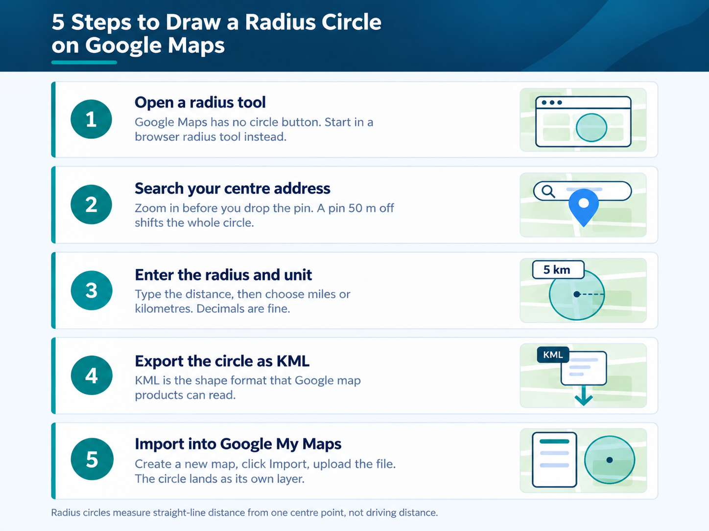
To draw a radius circle on Google Maps, make the circle in a radius tool first, export it as KML, then import that file into Google My Maps. The whole job takes about three minutes. You'll need a Google account to save and share the finished map.
1. Open a radius tool in your browser. These run on the same map data you already know.
2. Search your centre address. Zoom in before you drop the pin. A pin 50 m off shifts the whole circle.
3. Type the radius and pick your unit. Miles and kilometres both work, and decimals are fine.
4. Export the circle as KML. Most tools do this in one click.
5. Open Google My Maps and create a new map. Sign in first.
6. Click Import and upload the KML file. Your circle arrives as its own layer.
7. Rename the layer and set a fill colour. Then share the map link with your team.
How to Draw a Circle on a Map Using a Radius Tool
A dedicated radius tool is faster than the Google Maps route. You search an address, set the centre point, type a distance, and the circle appears at once. You can switch between miles and kilometres, drag the edge to resize, and draw radius circles on a map in layers.
1. Search the address, or click the map to place the centre.
2. Enter the radius and choose miles, kilometres or metres.
3. Drag the edge handle to resize. The number updates live.
4. Click elsewhere to drop a second circle.
5. Export the file, or take a screenshot.
Overlapping circles are worth the extra minute. Two riders, two circles. Where they overlap you have double cover, and where the gaps sit you have none. If you also need the ground covered and not just the distance, choose a tool that lets you draw a circle on the map and measure its area in the same step.
How to Measure the Radius of a Circle on a Map
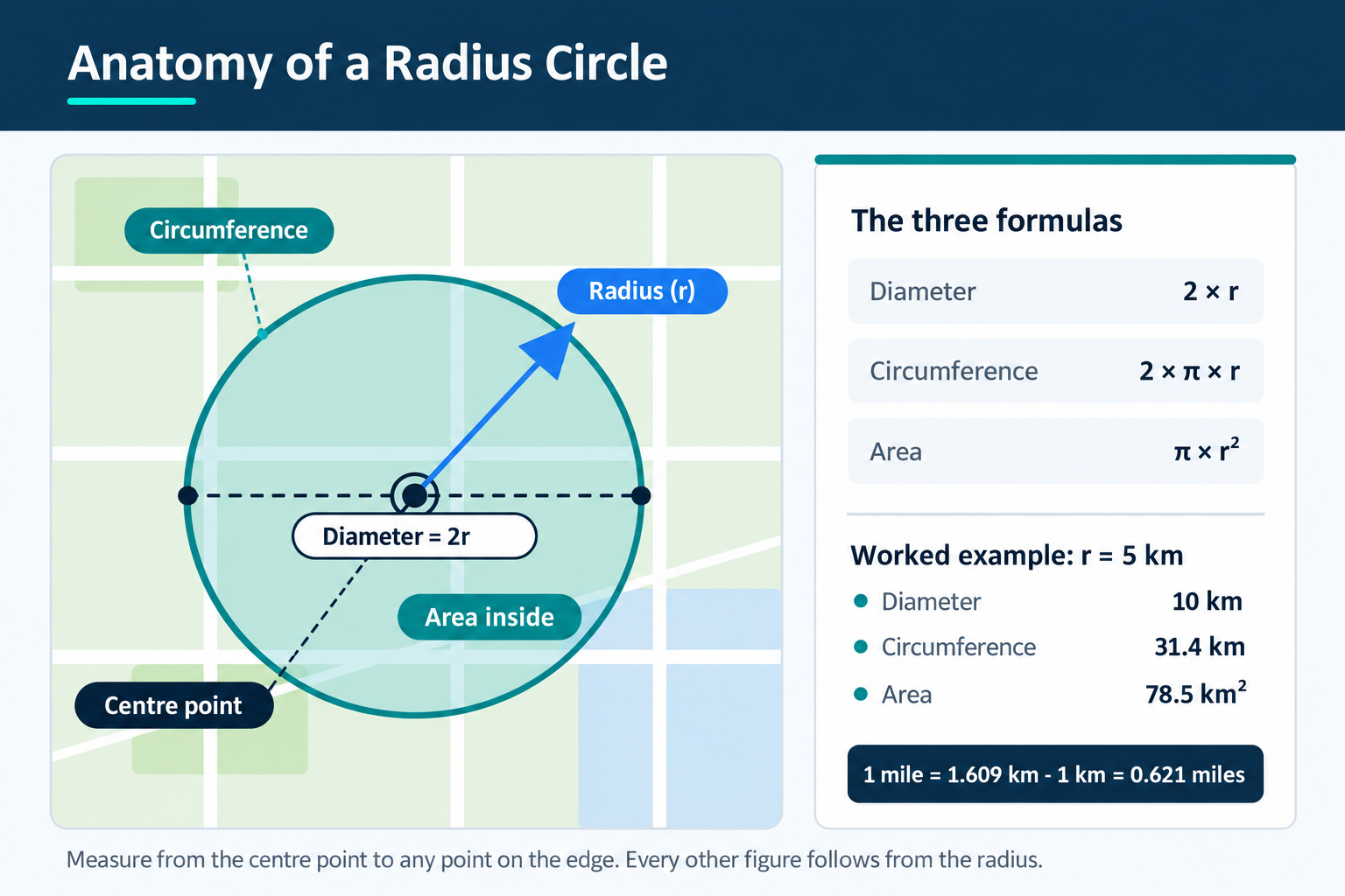
Most radius tools show the radius while you draw, so you simply read the number. To measure an existing circle by hand, measure from the centre point to any point on the edge. That distance is the radius. Every other figure comes from it.
In Google Maps, right-click the centre, choose Measure distance, then click the edge. The straight-line distance appears at the bottom of the screen.
Three formulas do the rest:
• Diameter = 2 × radius
• Circumference = 2 × π × radius
• Area = π × radius²
Take a 5 km radius. The diameter is 10 km, the circumference is 31.4 km, and the area is 78.5 km². In imperial units that radius is about 3.11 miles, since 1 mile equals 1.609 km.
One line rarely finishes the job. When you're checking how far a site sits from a road, a gate or a boundary, it's quicker to measure the distance between two points than to draw a full circle around it.
Real Uses for Radius Circles on a Map
• Delivery zones. Draw a service area around your kitchen and set the line riders won't cross.
• Real estate. Show buyers every listing within 2 miles of a station.
• Franchise territory. Give each branch a coverage zone, then check where they overlap.
• Event planning. See how far guests travel to reach your venue.
• Drone flights. Mark the restricted ring around an airport before you launch.
• Farm planning. Check which fields sit inside a spray buffer or an irrigation reach.
Radius Circle vs Drive-Time Area: Which Should You Use?
Use a radius circle when you want a simple boundary anyone can understand. Use a drive-time area when travel time decides the outcome. A circle treats a motorway and a mountain the same way. A drive-time area follows the road network instead.
| Radius circle | Drive-time area | |
| Measures | Straight-line distance | Actual travel time |
| Speed to build | Seconds | Needs live road data |
| Best for | Territories, buffers, quick checks | Delivery promises, commutes |
| Weak spot | Ignores rivers and roads | Shifts with time of day |
The circle misleads you where geography gets in the way. A 10 km circle over a bay includes water your van can't cross. Coastal towns, valleys and river cities suffer most.
Tips for Accurate Radius Measurement
• Zoom in before placing the centre. At low zoom, a single pixel can cover 100 m.
• Keep units consistent. Don't mix miles and kilometres inside one project.
• Allow for projection. Web Mercator, the projection behind most online maps, makes a circle near the poles cover far more screen than the same circle at the equator.
• Check the shape is geodesic. KML has no circle element, so tools fake one with a many-sided polygon. Cheap tools use too few sides.
• Save a KML export, not a screenshot. A screenshot throws away the coordinates.
Wrapping Up
Draw a circle on a map and you answer a question a straight line can't: what falls inside this distance? Read the radius, and the diameter, circumference and area follow in one step. Try a small radius around a place you already know well. The numbers will land faster that way.
Frequently Asked Questions
Not directly. Google Maps has no circle tool, and Google My Maps only draws lines and polygons. You create the circle in a radius tool, export it as a KML file, then import that file into My Maps as a layer.
Open a radius tool in your mobile browser rather than the Maps app. Set the centre, enter the distance, and screenshot the result. For a saved version, export the KML on a desktop and open the My Maps link on your phone.
Measure from the centre point to any point on the edge. In Google Maps, right-click the centre, choose Measure distance, then click the edge. Radius tools display the figure automatically as you drag or type.
Radius measures straight-line distance in every direction. Drive time measures how long the journey actually takes on roads. A 5 km radius and a 10-minute drive-time area can look completely different in a city with rivers or one-way systems.
Yes. Most radius tools let you place several circles and colour each one differently. This is how franchise owners spot overlapping territory and how delivery managers find the gaps between two depots.
The maths is exact. The accuracy depends on your centre point and the tool's geometry. A pin dropped by eye at low zoom can be tens of metres out, and that error applies to the whole boundary.
Google Earth Pro for desktop can. Open the Ruler, switch to the Circle tab, then click and drag from your centre. It reports the radius and lets you save the shape to your Places folder.
Export as KML to keep the coordinates, or as an image for a report. Google My Maps also gives you a shareable link with view or edit permissions, which is easier for clients than sending files.