



Wondering what lies within 1 mile, 5 km, or 10 miles of a location? Learn how to use a radius map to draw a distance circle and explore nearby areas easily.
Need to know what falls within 1 mile of your home, 5 km from a store, or 10 miles around a planned location? A radius map makes this easy to see. It draws a circle around a chosen center point based on a fixed distance.
Unlike a driving route, a radius measures direct geographic distance from the center. This makes radius maps useful for checking nearby places, planning service areas, comparing locations, and understanding geographic coverage. You can set the distance in miles or kilometers and quickly see which locations fall inside or outside the boundary. The key is knowing what that circle represents and how to read it correctly.
What Is a Radius Map?
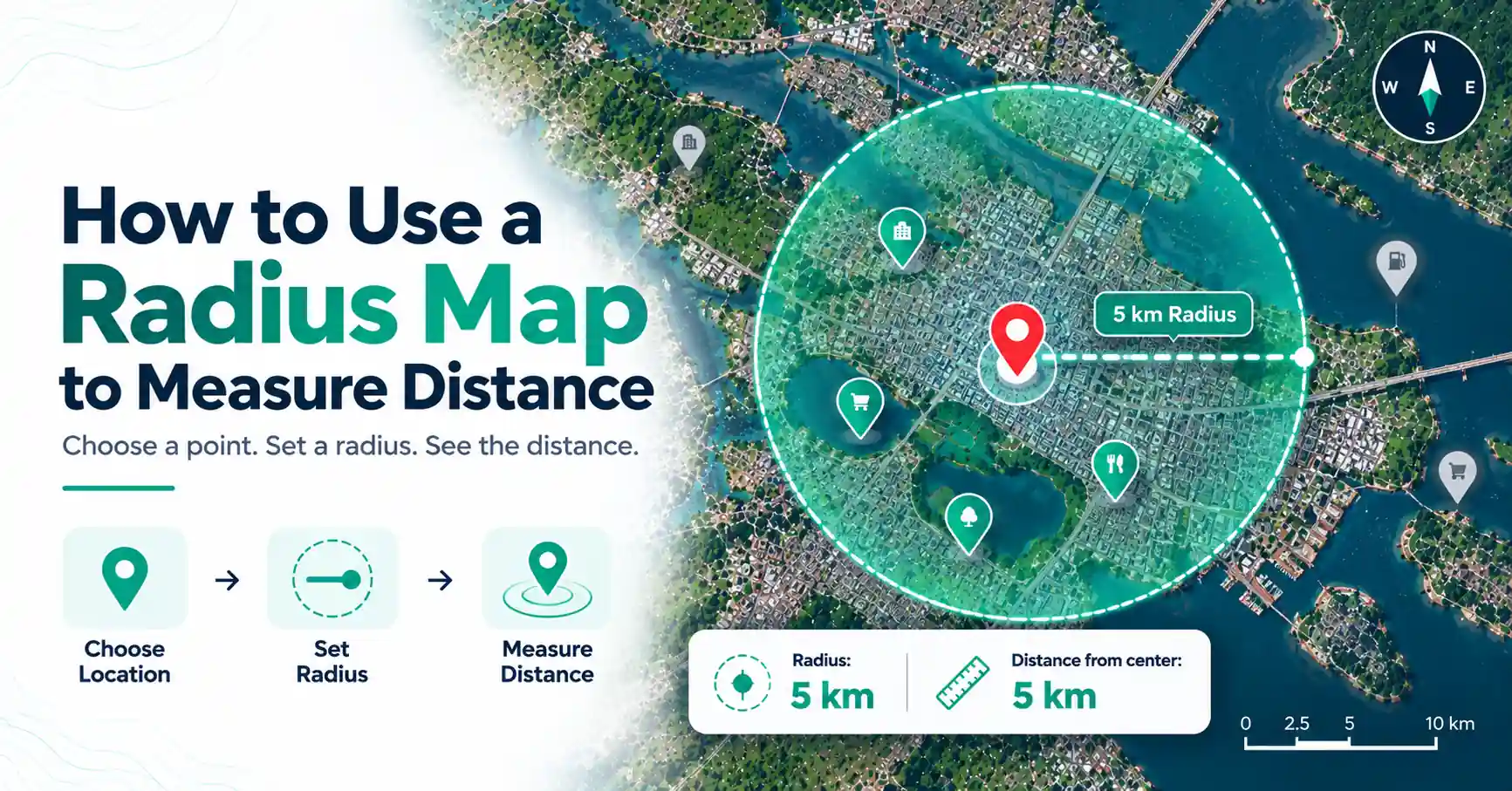
A radius map is a map that displays a circle around a chosen center point based on a fixed distance. Every point on the circle's boundary is the selected geographic distance from the center, such as 1 mile, 5 miles, or 10 kilometers, depending on how the mapping tool calculates distance.
For example, a 5-mile radius starts from one center location and extends 5 miles outward in every direction.
The radius is the distance from the center to the boundary. It should not be confused with diameter, which measures across the entire circle through its center.
So, a circle with a 5-mile radius has a 10-mile diameter.
How Does a Radius Map Work?
A radius map needs three basic pieces of information:
- A center location
- A radius distance
- A unit, such as miles or kilometers
The center could be a home, business, school, landmark, property, or GPS coordinate. Once you select it, the tool calculates the chosen distance outward and creates a circular boundary.
Suppose you choose a store as the center and enter 3 miles. The resulting circle shows an area extending 3 miles from the store in every direction.
This is direct geographic distance. It does not mean every place inside the circle can be reached by driving 3 miles.
How to Use a Radius Map to Measure Distance
A map radius tool can make distance measurement simple because you only need to choose a location and define how far the circle should extend.
Step 1: Choose Your Center Point
Start by selecting the location you want to measure from. This could be your current location, an address, a landmark, a business, or a pair of latitude and longitude coordinates.
Accuracy matters here. If the center point is in the wrong place, the entire radius will shift with it.
Step 2: Enter Your Radius
Choose how far you want the boundary to extend.
For example, you might enter:
- 1 km
- 5 km
- 1 mile
- 10 miles
The value represents the distance from the center to the edge of the circle.
Step 3: Select Miles or Kilometers
Check the measurement unit before drawing the circle. A 5-mile radius covers a much larger distance than a 5-kilometer radius.
A good radius map tool should make the selected unit clear.
Step 4: Draw the Radius
Use the tool's radius or circle feature to create the boundary. A map with radius tool will calculate the circle based on your center and selected distance.
Step 5: Read the Map
Now check which places appear inside, outside, or near the boundary. This can help you compare nearby locations without measuring each one separately.
How to Draw a Radius on a Map
To draw a radius on a map, you need a center point, a distance, and a mapping tool that supports geographic radius circles.
Select the location first. Then enter the required radius, such as 2 miles or 5 km. The tool calculates the boundary and places a circle around the center.
You could also draw a circle manually with a drawing feature, but a visual circle alone may not represent an accurate geographic distance. For distance-based work, use a tool that calculates the radius from map coordinates and scale.
How to Create a Mile Radius Map
A mile radius map uses miles as the unit for the distance between the center and circle boundary.
For example:
- A 1-mile radius extends 1 mile in every direction.
- A 5-mile radius extends 5 miles.
- A 10-mile radius extends 10 miles.
If a business wants to see neighborhoods within 5 miles of a location, it can place that address at the center and create a 5-mile circle.
When viewing radius miles on map results, remember that the circle represents direct distance. A neighborhood inside the circle could still require a longer road trip due to the local street network.
Can Google Maps Show a Distance Radius?
Google Maps can measure distances between selected points, but its standard consumer interface does not have a dedicated feature that automatically creates a fixed-radius circle around a location.
Its Measure distance feature is useful for checking straight-line distance between points. That is different from generating a complete circle where the boundary remains a fixed distance from one center.
If you need an actual radius circle, a specialized radius mapping tool or compatible mapping software can create one.
This distinction matters because measuring one 5 km line from a location does not automatically show every point that lies within a 5 km radius.
How Do I Put a 5 km Radius on Google Maps?
If you are asking, "How do I draw a radius on a Google Map?", the standard Google Maps interface does not automatically turn a 5 km measurement into a complete fixed-radius circle.
You can use its distance measurement to check straight-line distances from a location. However, creating a precise 5 km circular boundary generally requires a radius mapping tool or another mapping solution that supports circles based on geographic distance.
When trying to create a radius map with Google-based mapping data, make sure the tool is calculating a true geographic radius rather than placing a circle on the screen only for visual effect.
What Is a 1 km Radius From My Location?
A 1 km radius from your location includes points that are up to 1 km away in direct geographic distance from your selected position.
Imagine your location at the center of a circle. The circle extends 1 km north, south, east, west, and in every direction between them. Its diameter is about 2 km.
This does not mean every place inside the circle is reachable with a 1 km walk or drive. Roads may curve, and rivers, railway lines, private land, or other barriers can increase the actual travel distance.
Radius Distance vs Driving Distance
Radius distance and driving distance measure two different things.
Radius distance is the direct geographic distance from a center point. It does not follow streets, paths, or turns.
Driving distance follows the available road network. It depends on road layouts, crossings, restrictions, and other route conditions.
For example, a store could be 3 miles from your home in direct distance but require a 4.5-mile drive.
This is why a radius map should not be treated as a driving-distance or travel-time map. If your goal is to know how far you must actually travel, use a route-planning tool instead.
How Accurate Are Radius Maps?
The accuracy of a radius map depends on the tool, the center point, coordinate precision, mapping method, and how geographic distance is calculated.
For a small radius, a well-designed mapping tool can provide a useful representation of a distance boundary. Over larger areas, calculations also need to account appropriately for the Earth's curved surface.
The starting point matters as well. If you select the center of a large property instead of its entrance, for example, the resulting boundary will be based on that different location.
A manually drawn visual circle should not be assumed to represent an exact geographic radius. For legal property boundaries, professional surveying, or safety-critical work, use appropriate professional geospatial methods rather than a general-purpose radius map.
Common Uses of a Radius Map
Radius maps can answer a simple question: What is within a certain direct distance of this location?
That makes them useful for tasks such as:
- Finding places near a home or business
- Viewing a basic service area
- Comparing possible business locations
- Researching land and properties
- Planning events or facilities
- Exploring possible delivery areas
- Comparing schools or other facilities
- Viewing nearby landmarks
- Supporting basic geographic analysis
- Researching destinations before a trip
For example, you could draw a 10-mile radius around a proposed facility and compare which towns fall inside the boundary.
A radius provides geographic context, but travel-based decisions may also require road-distance or travel-time data.
How Do I Calculate Distance Using a Map?
The right method depends on the type of distance you need.
If you want the direct distance between two locations, use a point-to-point measurement tool. If you want to know how far you need to drive, use directions or route planning.
If your question is what lies within a fixed distance in every direction from one location, use a radius map.
Choosing the right measurement method prevents a direct distance from being mistaken for an actual travel route.
Common Mistakes When Using Radius Maps
One common mistake is confusing radius with diameter. A 5-mile radius extends 5 miles from the center, while its full diameter is 10 miles.
Another mistake is treating the radius as driving distance. Roads rarely follow the circular boundary, so actual travel distances can differ.
Also check your center point and measurement unit. Accidentally selecting kilometers instead of miles can change the intended coverage considerably.
Avoid drawing a circle by eye when distance accuracy matters. A visual circle may look correct without matching the map's geographic scale.
Finally, do not assume that every location inside the circle takes the same amount of time to reach. Travel time depends on routes and real-world conditions, not just direct distance.
Final Thoughts
A radius map provides a simple way to view a fixed geographic distance around a location. Choose a center point, set the distance in miles or kilometers, and create the circle to see what falls within the boundary.
The most important point is understanding what the result represents. A radius measures direct distance from the center, not driving or walking distance. Use a radius tool for geographic proximity and a route-planning tool when you need to understand the actual journey between locations.
Frequently Asked Questions
Choose a center point and set a fixed distance, such as 1 mile or 5 km. A radius mapping tool measures that distance outward from the center in every direction and creates a circular boundary. The radius is the distance from the center to the edge, not across the full circle.
Google Maps can measure straight-line distance between selected points, but its standard consumer interface does not automatically draw a fixed-distance radius circle. A dedicated radius-circle tool or compatible mapping software is more suitable when you need to display a complete boundary around one center point.
A 5 km radius means the boundary of a circle is 5 km from its center in every direction, based on the geographic distance method used. The circle therefore has a diameter of about 10 km. It does not mean every location inside the circle is reachable by a 5 km road journey.
The right map or tool depends on what you want to measure. Use route planning for driving distance, point-to-point measurement for direct distance, a radius map for a fixed distance around one center, and suitable GIS tools when you need more advanced geographic calculations or analysis.
A radius is a specific type of distance. It measures from the center of a circle to its boundary. On a radius map, the chosen radius determines how far the circular boundary extends from the selected location in every direction.
No, a standard radius map normally represents direct geographic distance from a center point rather than driving distance. Driving distance follows the road network and may be longer. Mapping an area based on road distance or travel time requires route or network analysis rather than a simple circular radius.