



Learn how to find and read land parcel maps, understand property boundaries, and measure acreage online. Explore parcel map accuracy, Vermont parcel maps, and the key differences between GIS maps and professional land surveys.
You find a property for sale and want to check its size before making an offer. An online map shows lines around the land, but how do you know what those lines mean?
A land parcel map helps you view property boundaries, identify land parcels, and check available property records. It can also help you estimate acreage before buying land or planning improvements.
However, the lines on a parcel map do not always show exact legal boundaries.
This guide explains how to find parcel maps, read property lines, measure land area, and understand when a professional survey is needed.
What Is a Land Parcel Map?
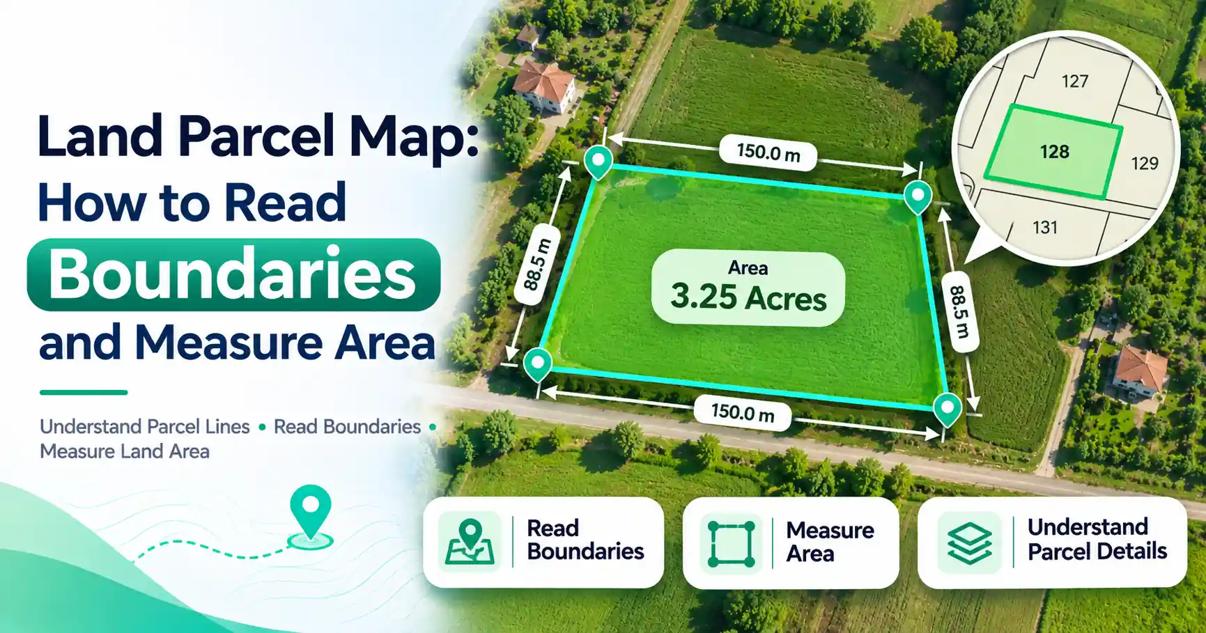
A land parcel map shows individual pieces of land, called parcels, within a geographic area. It displays mapped property boundaries and may include parcel numbers, acreage, roads, and assessment details. Local governments use these maps to manage property records, taxes, and land planning.
A parcel is a defined piece of land. It may contain a house, several buildings, farmland, or no structures at all.
One parcel can have more than one street address. Likewise, a street address does not always identify a single parcel.
Most modern land parcel maps use Geographic Information Systems (GIS). GIS connects locations on a map with information stored in property databases.
These maps may also be called tax parcel maps, cadastral maps, or property parcel maps.
What Information Does a Land Parcel Map Show?
A parcel land map can contain several types of property information. The details depend on the local government and mapping provider.
Map Feature | What It Means |
| Parcel boundary | The mapped outline of a land parcel |
| Parcel ID or APN | A number used to identify a property in local records |
| Acreage | The listed or calculated land area |
| Roads and streets | Nearby roads and access routes |
| Ownership details | Available property ownership information |
| Assessment data | Property information used for tax assessment |
| Map scale | The relationship between map distance and actual ground distance |
An Assessor's Parcel Number (APN) helps local agencies identify property for tax purposes. Some areas use different names or numbering systems.
Acreage may come from assessment records or GIS calculations. These figures can differ from the area shown in a recorded survey.
Some parcel viewers display ownership information, while others provide limited public details.
Always check the source before relying on the information.
How to Find a Land Parcel Map Online
You can often find land parcel maps through official county, city, or state government websites.
Step 1: Find an Official GIS Parcel Viewer
Search for your county's GIS parcel map or property assessor map.
For example, search:
"[County name] GIS parcel map"
Look for a mapping system maintained by a county assessor, GIS department, municipality, or state agency.
Official government viewers are useful starting points because they often connect mapped parcels with public property records.
Step 2: Search for Your Property
Open the parcel viewer and find its search function.
Depending on the system, you may search using:
- Property address
- Parcel ID or APN
- Owner name, where available
- Town or geographic location
If the address search does not work, try using the parcel number from a property tax bill.
You can also navigate the map manually to locate the land.
Step 3: Review the Parcel Details
Select the parcel to view its available information.
Check the parcel number, listed acreage, location, and assessment details.
Some websites also provide access to related tax records, deeds, or recorded documents.
Compare the details with your property paperwork to make sure you have selected the correct parcel.
Step 4: Check the Map Update Date
Before using the information, review the map's update date and disclaimer.
A property that was recently divided or sold may not appear correctly in the current parcel layer.
For important decisions, confirm the latest details with the local office responsible for maintaining property records.
How to Read Property Boundaries on a Parcel Map
A land parcels map may look complicated at first. However, most of its features are easy to understand once you know what to check.
1. Identify the Parcel Outline
Parcel boundaries usually appear as lines separating neighboring properties.
Select your parcel and follow the outline to understand its mapped shape.
Some parcels have four corners, while others have several irregular edges.
2. Check Nearby Parcels
Look at the properties surrounding your land.
Their parcel numbers can help you identify neighboring lots and understand how the area is divided.
This can be useful when researching land access or planning future improvements.
3. Examine Roads and Rights-of-Way
Roads, access routes, and rights-of-way may affect how a property can be used.
A right-of-way can allow someone to travel across land without owning it.
Do not assume that a road edge always marks the legal property boundary.
4. Compare Boundaries with Aerial Images
Aerial images can help you identify buildings, fences, trees, and driveways.
However, these visible features may not follow legal property lines.
For example, a fence may stand several feet inside a property rather than directly on its boundary.
5. Understand the Map Scale
Zooming in makes details easier to see, but it does not improve the accuracy of the original parcel data.
A boundary line that looks precise on your screen may still come from an older map.
For important boundary decisions, compare the GIS parcel map with recorded deeds, subdivision plats, and professional survey documents.
How Accurate Are Land Parcel Maps?
Land parcel maps are useful for general property research, but their accuracy varies. Some boundaries come from older records converted into digital form. Aerial images and parcel outlines may not align perfectly. Therefore, a GIS parcel map should not be treated as a certified boundary survey.
Accuracy depends on the source records, mapping methods, and how often the data is updated.
Imagine a parcel viewer showing your driveway close to a neighboring property line.
That does not prove the driveway crosses the boundary. The mapped line may be misplaced, or the driveway may fall within an easement.
A licensed land surveyor can examine recorded documents, physical boundary markers, and field measurements.
For fence placement, boundary disputes, and construction near property lines, a professional survey may be necessary.
How to Measure Land Parcel Area Online
You can estimate parcel acreage using an online map area measurement tool.
These tools let you draw a shape around a piece of land and calculate the enclosed area.
Steps to Measure Land Area
- Open an online map area calculator.
- Search for the property or navigate to its location.
- Identify the approximate parcel outline.
- Mark points around the land's visible boundaries.
- Complete the shape to enclose the area.
- Review the estimated area in square feet, acres, or other available units.
For example, imagine you want to estimate the size of a field before planning landscaping.
You can trace the field's outline and calculate its approximate area.
Compare the result with the acreage listed in official parcel records.
The values may differ because of map alignment, rounding, boundary interpretation, or different measurement methods.
Important: Online area calculators provide estimates. They cannot independently confirm legal property boundaries.
Vermont Land Parcel Map: Where to Find Property Boundaries
If you need a Vermont land parcel map, the Vermont Center for Geographic Information (VCGI) provides statewide parcel mapping resources.
Vermont's Parcel Viewer helps users explore available parcel information collected from municipalities across the state.
It can be useful for researching property locations, mapped boundaries, and parcel details.
How to Find a Parcel in Vermont
- Search for the official Vermont Parcel Viewer.
- Open the statewide parcel mapping system.
- Search for a town, address, or parcel identifier using the available options.
- Select the relevant parcel.
- Review its mapped boundaries and available property information.
- Check with the municipality when current or official records are needed.
Vermont also uses a School Property Account Number (SPAN) in its property tax system.
A SPAN can help identify property records, although available search options depend on the mapping system.
Are Vermont Parcel Maps Legally Accurate?
Vermont parcel maps are useful for property research, but mapped boundaries should not be treated as certified survey lines.
Municipal records and statewide mapping data may have different update schedules.
For recorded deeds and plats, contact the appropriate town clerk.
If you need to establish a legal boundary, consult a licensed land surveyor.
Parcel Map vs Land Survey: What's the Difference?
A parcel map helps you research land, while a professional survey determines boundary locations using records and field evidence.
Factor | Land Parcel Map | Professional Land Survey |
| Purpose | Property research | Boundary determination |
| Data source | GIS and property records | Records and field measurements |
| Accuracy | Varies by dataset | Based on professional survey methods |
| Cost | Often free online | Paid professional service |
| Legal boundary use | Not sufficient by itself | Used for formal boundary work |
| Best use | Planning and research | Disputes, construction, boundary verification |
A parcel map can help you identify which property to research.
A survey provides stronger evidence of where its boundaries lie on the ground.
Not every property purchase requires a new survey. The need depends on local rules, property history, and the intended use.
Common Mistakes When Using Land Parcel Maps
Avoid these common errors when reading parcel maps.
1. Assuming boundary lines are exact
GIS lines may contain errors. Use professional survey evidence when exact boundaries matter.
2. Confusing parcel numbers with addresses
One parcel can have multiple addresses. Confirm its identifier in official property records.
3. Using outdated parcel information
Recent subdivisions or ownership changes may not appear immediately. Check the latest available records.
4. Treating fences as property lines
A fence may not follow the legal boundary. Review survey evidence before installing or moving one.
5. Ignoring easements and rights-of-way
A property may contain access or utility rights. Check recorded documents before planning construction.
When Should You Use a Parcel Map?
A land parcel map is useful when you want to:
- Check approximate property size.
- Research land before buying.
- Identify neighboring parcels.
- Compare listed acreage.
- Plan landscaping or land improvements.
- Find parcel numbers for further research.
However, a professional survey may be needed for boundary disputes, fence placement near property lines, construction setbacks, subdivisions, or legal boundary documents.
Parcel maps are valuable starting points, but their limits matter.
Use them to understand land information and make early plans. When exact boundaries are important, rely on recorded evidence and qualified professionals.
Frequently Asked Questions
A land parcel map shows individual pieces of land and their mapped boundaries. It may include parcel numbers, acreage, roads, and assessment information. These maps help users research properties and understand how land is divided.
Visit your county assessor's website or local GIS mapping portal. Search using your property address or parcel number. If no online viewer is available, contact the local government office responsible for property records.
Many government parcel maps are available online for free. Some jurisdictions charge for printed copies, detailed records, or special mapping services. Availability and fees depend on the local government.
Accuracy varies by source, mapping method, and update history. GIS parcel boundaries may not align exactly with surveyed property lines. Do not rely on them alone for fences, boundary disputes, or legal decisions.
Yes. You can use a parcel map to identify the approximate outline and estimate its area with an online measurement tool. Compare the result with recorded acreage, and remember that map estimates are not certified surveys.
A parcel map displays property information for general reference. A professional land survey uses records, field measurements, and boundary evidence to determine property lines. Surveys are more appropriate when legal boundary certainty is required.
The Vermont Center for Geographic Information provides an official statewide Parcel Viewer. It displays available parcel mapping data and helps users research properties. For authoritative recorded documents, contact the relevant town clerk.
Some parcel maps display ownership information from public assessment records. Others provide limited details or connect to separate property databases. The information available depends on local disclosure rules and the mapping system.