



Is GPS accurate enough to measure your land? Compare GPS measurement apps and professional land surveys, including accuracy, costs, property boundaries, and the best method for your needs.
You want to measure your land before building a fence, planting crops, or buying a property. Should you use a GPS app or hire a land surveyor?
Both methods can help, but they serve different purposes. GPS land surveying uses satellite signals to measure positions on Earth. A smartphone app can estimate land area and distance in minutes. A professional survey goes further by checking property records, locating boundary markers, and identifying legal property lines.
The right choice depends on the accuracy you need, your budget, and how you plan to use the results. This guide compares both methods so you can avoid costly measurement mistakes.
Land Survey vs GPS Measurement: What's the Difference?
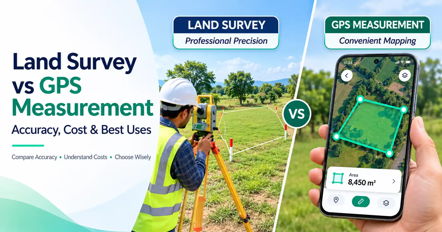
A professional land survey identifies and documents property boundaries using field measurements, legal records, and physical evidence. A GPS app estimates locations, distances, or areas using satellite positioning or map data. Both can measure land, but only a properly conducted professional boundary survey can establish boundary findings for legal purposes.
Factor | Professional Land Survey | Smartphone GPS App |
| Main purpose | Identify boundaries and survey features | Estimate area and distance |
| Accuracy | High, based on survey methods and conditions | Varies with GPS signals and map quality |
| Cost | Usually hundreds to thousands of dollars | Often free or low-cost |
| Legal boundary use | Suitable when properly performed and documented | Not suitable |
| Equipment | Survey-grade GNSS, total stations, and other tools | Smartphone or online map |
| Best use | Property lines, disputes, construction | Farming, landscaping, early planning |
The key difference is not simply accuracy. It is also what the measurement proves.
A map may show that a field covers five acres. That does not prove where its legal boundaries begin or end.
How Does GPS Land Surveying Work?
GPS surveying uses signals from satellites to calculate positions on the ground. GPS is one part of GNSS, a wider group of satellite navigation systems.
A receiver compares signals from several satellites to determine its location. The result depends on signal quality, equipment, and surrounding conditions.
There are three common approaches.
Smartphone GPS Measurement
A phone uses satellite signals and other location data to estimate its position. A measurement app can record points as you move around a field.
However, each recorded point may contain an error. These errors can affect the final area.
Map-Based GPS Measurement
Online tools let users select points on a digital map. The software then calculates the area or distance between those points.
This method is useful when the land is difficult to walk around. Its accuracy depends on map quality and how carefully the user marks the edges.
Professional GNSS Surveying
Surveyors use specialized receivers and correction methods to improve positioning accuracy.
One method, called Real-Time Kinematic (RTK), uses correction data to reduce positioning errors. Under suitable conditions, professional equipment can achieve centimeter-level positioning.
GPS and surveying therefore work together. Many licensed surveyors use GNSS as one part of their work, alongside other instruments and boundary research.
GPS vs Land Survey Accuracy: Which Is More Reliable?
A professional land survey is more reliable for establishing property boundaries. However, GPS land measurement accuracy depends on the equipment and measurement method, not simply whether GPS is used.
According to GPS.gov, smartphones are typically accurate within about 4.9 meters (16 feet) under open sky. Accuracy can become worse near trees, buildings, and bridges.
Professional receivers with correction systems can achieve positioning accuracy within a few centimeters under favorable conditions.
These figures describe positioning accuracy, not the accuracy of a complete land area measurement.
What Affects GPS Accuracy?
Several factors can change the result:
- Trees and buildings: Objects can block or reflect satellite signals.
- Weather and atmosphere: Signal travel conditions can affect positioning.
- Receiver quality: Professional equipment offers capabilities that many phones lack.
- Map imagery: A visible fence or road may not match a legal boundary.
- Point selection: Incorrectly placed corners can change the calculated area.
For example, imagine measuring a rectangular field. If one corner is placed several feet away from its true position, the estimated area may change.
A larger field may tolerate a small error for rough planning. The same error could be serious when placing a fence beside a neighbor's property.
This is why GPS vs land survey accuracy should be judged by the intended use.
How Much Does a Land Survey Cost?
Land survey cost varies with property size, location, terrain, records, and the type of survey required.
For U.S. properties, published 2026 estimates differ considerably. HomeGuide reports typical land survey costs of 200–1,200, while Angi reports an average of about $2,300, with many projects costing 800–5,500.
These are general estimates, not guaranteed prices.
What Changes the Price?
Property size: Larger parcels may require more fieldwork, especially when boundaries are long or irregular.
Terrain: Hills, thick vegetation, and difficult access can increase the time needed.
Survey type: Boundary, topographic, construction, and land-title surveys involve different tasks.
Property records: Missing documents or conflicting descriptions may require additional research.
Location: Labor rates and local survey requirements vary.
A smartphone app or online map tool may cost little or nothing for basic measurements. However, it does not provide the same professional service.
Before hiring a surveyor, request written quotes that explain the work, expected deliverables, and any extra charges.
Professional Land Survey vs GPS App: Best Uses
Choosing between a professional land survey vs GPS app becomes easier when you consider what you need to accomplish.
When Should You Hire a Professional Surveyor?
A licensed surveyor is the better choice when boundary certainty matters.
Common situations include:
- Buying land when property lines need verification.
- Installing a fence close to a neighboring property.
- Resolving a disagreement over property corners.
- Dividing land into smaller parcels.
- Planning construction that depends on setbacks.
- Identifying easements or other recorded boundary details.
For example, a homeowner may see a straight fence line on a satellite map. But the fence might not sit on the actual property boundary.
A professional surveyor can examine deeds, recorded plats, and existing monuments to determine the boundary.
When Is a GPS Measurement App Enough?
A GPS or map measurement tool is useful when you need an estimate rather than legal proof.
Examples include:
- Estimating farmland acreage.
- Planning a garden or lawn.
- Comparing possible building sites.
- Measuring a walking route.
- Estimating material needs for landscaping.
- Checking the rough size of an open field.
Suppose a farmer wants to estimate how much land needs fertilizer. A map-based area measurement may provide a useful starting point.
But if the farmer is buying an adjoining parcel, a professional survey may be necessary to verify the boundaries.
Can GPS Replace a Professional Land Survey?
No. A GPS app cannot replace a professional boundary survey when legal property lines must be established. GPS can measure positions, but it cannot independently interpret deeds, resolve conflicting records, or determine which physical markers define ownership. A licensed surveyor combines measurements with legal and historical evidence.
A property boundary is not always the same as a visible fence, driveway, or tree line.
Surveyors may need to examine:
- Recorded deeds and subdivision plats.
- Existing boundary monuments.
- Previous survey documents.
- Neighboring property descriptions.
- Applicable state and local rules.
Even a highly accurate GPS coordinate does not prove that a particular point is a legal property corner.
The need for a formal survey depends on local law, the project, and requirements set by lenders, title companies, or permit offices.
How to Measure Land Area Using FieldCalc
If you only need an area estimate, FieldCalc offers a practical way to measure land on a digital map.
You can measure land area on a map without first hiring a surveyor.
Follow these steps:
- Open the FieldCalc Map Area Calculator.
- Search for or locate the land you want to measure.
- Select the area measurement tool.
- Place points around the visible edges of the land.
- Close the shape and review the calculated area.
- Adjust the points if the outline needs correction.
For better results, zoom in before marking corners. Use clear landmarks and check each point carefully.
FieldCalc can help with early planning, acreage estimates, and land comparisons. However, map measurements are not certified boundary surveys.
Do not use an estimated map outline as proof of ownership or as the sole basis for construction near a property line.
Which Land Measurement Method Should You Choose?
The best method depends on the purpose of your measurement.
Your Goal | Recommended Method |
| Estimate acreage quickly | Online map area calculator |
| Check a rough location on-site | Smartphone GPS |
| Collect high-precision field positions | Professional GNSS equipment |
| Confirm legal property lines | Licensed land surveyor |
| Resolve a boundary dispute | Professional survey and appropriate legal advice |
For everyday planning, a GPS measurement tool is often a sensible starting point.
For property transactions, boundary disputes, or work near legal property lines, professional surveying provides the evidence and expertise that an app cannot offer.
Final Thoughts
GPS apps and professional land surveys are both valuable, but they solve different problems.
Use GPS measurement tools when you need fast, affordable estimates for farming, landscaping, or early project planning. Choose a professional survey when boundary accuracy, legal evidence, or major property decisions are involved.
The safest approach is to match the measurement method to the risk of getting it wrong.
Frequently Asked Questions
Accuracy depends on the equipment and conditions. Smartphone GPS may have errors of several meters, while professional GNSS systems with RTK corrections can achieve centimeter-level positioning under suitable conditions. Accurate positions alone do not establish legal property boundaries.
Smartphone GPS is not reliable enough to establish property lines. A displayed coordinate may be close to a boundary but cannot confirm its legal position. A licensed surveyor uses property records, physical evidence, and field measurements to identify boundaries.
GPS apps can replace some basic measuring tasks, such as estimating acreage or distance. They cannot replace professional boundary surveys. Legal boundary work requires research, technical judgment, and compliance with applicable surveying standards.
In the United States, professional surveys commonly cost hundreds to several thousand dollars. Published estimates vary widely. The final price depends on property size, terrain, survey type, location, and the condition of existing records. Request a local quote for an accurate estimate.
GPS surveying uses satellite signals to determine positions. Traditional methods often use instruments such as total stations to measure angles and distances. Professional surveyors may combine both approaches to achieve reliable results in different field conditions.
Yes. You can use a GPS app or online map tool to estimate your property's area and distances. These measurements are useful for general planning, but they should not be treated as verified legal property boundaries.
GPS measurements can help estimate fence length and material costs. However, they should not be used alone to place a fence near a property boundary. Confirm the boundary through reliable survey evidence or a licensed surveyor before installation.
For a quick acreage estimate, use a map area calculator and trace the land carefully. For accurate field data, professional GNSS equipment may be suitable. If the acreage must be tied to verified legal boundaries, hire a licensed land surveyor.