



Are GPS coordinates more accurate than street addresses? Learn the key differences, how location accuracy works, how to convert coordinates and addresses, and which method is best for navigation, deliveries, rural properties, and emergencies.
A delivery driver reaches the correct street but cannot find your house. The address points to a nearby building, while the entrance is on another road. Sharing a GPS pin could help the driver find the right location.
This is a common example of GPS coordinates vs address in everyday life.
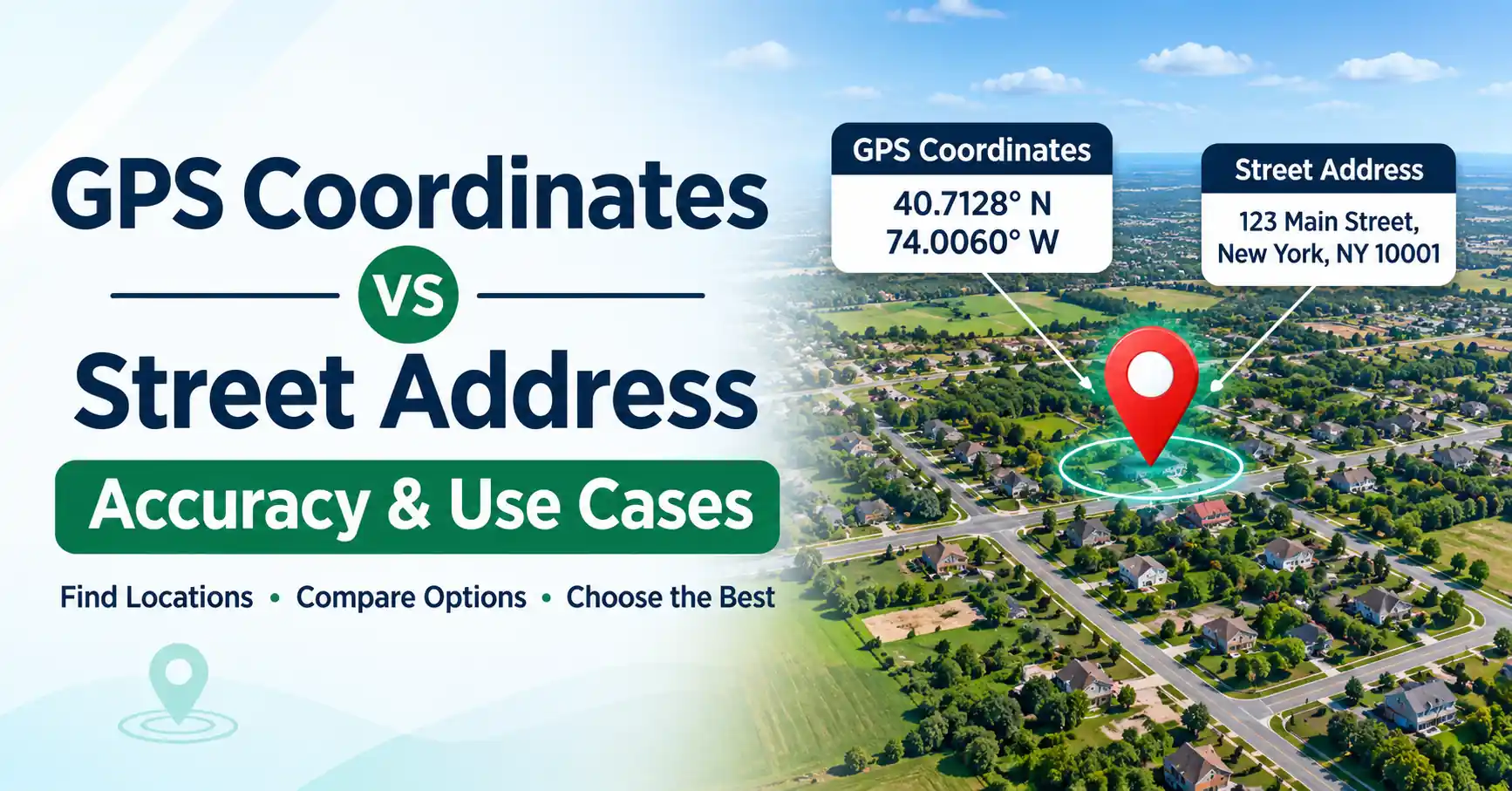
Street addresses identify named locations, while GPS coordinates describe geographic positions using latitude and longitude.
Both are useful, but neither is always more accurate.
Understanding their differences can help with navigation, deliveries, rural properties, and emergencies. This guide explains how they work, their accuracy, and when to use each method.
What Are GPS Coordinates?
GPS coordinates are numbers that describe a geographic position using latitude and longitude. They help identify locations on Earth, including places without street addresses. Coordinates are commonly used for navigation, mapping, outdoor activities, and location sharing.
A coordinate pair contains two values:
- Latitude: Shows how far north or south a location is from the equator.
- Longitude: Shows how far east or west a location is from the prime meridian.
Coordinates are often written in decimal degrees.
For example, the illustrative coordinates 40.7128, -74.0060 point to a location in New York City.
The first number represents latitude, while the second represents longitude.
A coordinate pair identifies a geographic position. It does not automatically identify a building entrance, property owner, or legal land boundary.
What Is a Street Address?
A street address is a written description used to identify a building, property, or delivery location.
In the United States, it usually includes a building number, street name, city, state, and ZIP code.
For example:
123 Example Street, Springfield, IL 62701
This is an illustrative address format, not a verified property location.
Street addresses are commonly used for mail delivery, navigation, government records, and everyday communication.
However, not every location has a formal address. Remote fields, hiking trails, and some rural properties may be difficult to identify using street names alone.
A mapped address may also point to a building, property center, or nearby road rather than the exact entrance.
GPS Coordinates vs Address: Key Differences
The main difference between GPS coordinates vs physical address information is how each identifies a location.
GPS coordinates use geographic numbers, while street addresses use names and numbering systems.
Factor | GPS Coordinates | Street Address |
| Location format | Latitude and longitude | Number, street, city, ZIP code |
| Main purpose | Identify geographic positions | Identify named destinations |
| Accuracy | Depends on positioning quality | Depends on address data |
| Rural coverage | Useful without formal addresses | May be limited |
| Ease of understanding | Requires coordinate interpretation | Easy to read and share |
| Navigation | Useful for specific map points | Useful for road destinations |
| Internet requirement | GPS reception does not require internet | Address lookup may require map data |
| Best use | Remote locations and precise meeting points | Deliveries and official records |
Coordinates can identify a point in an open field, while an address may identify the farm that contains it.
However, a GPS point is not automatically more accurate than a verified address.
The better choice depends on the location and what you need to accomplish.
GPS Coordinates Accuracy vs Street Address Accuracy
GPS coordinates accuracy and street address accuracy measure different things.
GPS accuracy describes how closely a calculated position matches the actual location. Address accuracy describes whether a mapped address correctly identifies the intended building, property, or destination.
Both can contain errors.
How Accurate Are GPS Coordinates?
Smartphone GPS accuracy varies depending on the device and surrounding environment.
Under open skies, smartphones can often estimate outdoor positions within several meters. GPS.gov reports approximately 4.9 meters as a typical smartphone accuracy figure under open-sky conditions.
This is not a guaranteed result for every device or location.
Accuracy can decrease because of:
- Tall buildings blocking satellite signals.
- Trees and dense vegetation.
- Indoor environments.
- Signals reflecting off nearby surfaces.
- Device hardware and positioning conditions.
A phone may display coordinates with many decimal places, but those digits do not guarantee centimeter-level accuracy.
How Accurate Are Street Addresses?
Street address accuracy depends on the quality of the mapping database.
A digital map may place an address at:
- A building entrance.
- The center of a property.
- A rooftop.
- An estimated point along a road.
New buildings, renamed streets, and incomplete rural records can also cause errors.
This explains why a navigation system may direct someone to the wrong side of a property.
Which Is More Accurate?
Neither method is always more accurate.
A reliable GPS position may be better for identifying a specific outdoor location.
A verified street address may be more useful for locating a building, receiving deliveries, or completing official paperwork.
For difficult destinations, using both can improve communication.
Latitude and Longitude vs Address: How Do They Work?
The difference between latitude and longitude vs address information is how locations are represented.
Latitude and longitude describe geographic positions using numbers.
Street addresses describe locations using an established addressing system.
For example, a GPS coordinate pair can identify a point along a hiking trail, even when no road or building exists nearby.
A street address usually refers to a recognized property or destination.
Two important processes connect these systems.
Geocoding converts a street address into geographic coordinates.
Reverse geocoding converts geographic coordinates into a likely street address or nearby place description.
Both processes depend on available map data.
Reverse geocoding may return the nearest mapped address rather than the exact location represented by the coordinates.
How to Convert GPS Coordinates to a Street Address
Converting GPS coordinates to street address information is called reverse geocoding.
Follow these steps:
- Copy the latitude and longitude values.
- Open a digital mapping service that supports coordinate searches.
- Enter the coordinates in decimal-degree format.
- Locate the position shown on the map.
- Check whether a street address or nearby place appears.
- Compare the result with available map imagery.
For example, coordinates may be written as:
40.7128, -74.0060
Enter latitude first, followed by longitude.
Some locations, such as forests or remote fields, may not have a street address.
In those cases, the mapping service may show a nearby road or place name instead.
Always verify the result before using it for deliveries or important travel.
How to Convert a Street Address to GPS Coordinates
Converting a street address to GPS coordinates is called geocoding.
You can do this using a digital map or address lookup tool.
Follow these steps:
- Open a mapping service.
- Enter the complete street address.
- Select the correct result.
- Find the location's latitude and longitude.
- Copy the coordinate pair.
- Check that the map pin matches the intended destination.
For example, a large property may have a mailing address near its main building.
The coordinates returned by geocoding may represent that building rather than the driveway entrance.
Check the map carefully if you need coordinates for a specific access point.
GPS Coordinates for Rural Properties: Why Are They Useful?
GPS coordinates for rural properties are especially helpful when street addresses are missing, incomplete, or difficult to navigate.
They can identify locations such as:
- Agricultural fields.
- Remote cabins.
- Farm entrances.
- Rural construction sites.
- Forest access points.
- Large land parcels.
Consider a farm with one mailing address and several entrances.
A visitor using the street address might arrive at the farmhouse instead of the correct field gate.
Sharing coordinates for the intended entrance can make navigation easier.
Coordinates are also useful when a property covers a large area and the destination is far from its mailing address.
However, GPS coordinates do not establish legal property boundaries.
For land ownership or boundary disputes, professional survey evidence is still needed.
GPS Location vs Address: Which Should You Use?
Choosing between GPS location vs address information depends on the situation.
Situation | Recommended Method | Reason |
| Home delivery | Street address and entrance details | Helps identify the delivery destination |
| Emergency assistance | Address and available GPS location | Gives responders more location information |
| Hiking or camping | GPS coordinates | Useful where addresses do not exist |
| Rural property visit | Address and GPS coordinates | Helps identify the correct access point |
| Official documents | Registered street address | Supports formal identification |
| Large venue meeting | GPS pin or entrance location | Identifies a specific meeting point |
| Property boundary research | Survey and land records | Coordinates alone do not prove boundaries |
For deliveries, an address is usually the starting point.
For hiking, camping, or remote travel, coordinates can be more practical.
During emergencies, provide your location as clearly as possible and follow the dispatcher's instructions. Emergency location systems and coordinate support vary by region.
Common Problems When Using GPS Coordinates and Addresses
Both location methods can produce confusing results.
1. Incorrect Coordinate Format
Entering longitude before latitude can place the pin in the wrong location.
Always check the coordinate order and whether negative signs are correct.
2. Weak GPS Signal
Buildings, trees, and indoor conditions may affect positioning.
Move to a more open location when safe and allow the device to update its position.
3. Outdated Address Information
New roads and buildings may not appear in mapping databases immediately.
Verify the destination using available property details or local information.
4. Wrong Entrance Location
A map may identify the correct property but guide visitors to the wrong entrance.
Share entrance coordinates or clear access instructions when necessary.
5. False Precision
Coordinates with many decimal places may appear highly accurate.
However, extra digits cannot correct an inaccurate GPS measurement.
Which Is Better: GPS Coordinates or a Street Address?
GPS coordinates are useful for identifying geographic positions, especially in remote areas.
Street addresses are better suited to everyday communication, deliveries, and official records.
Neither method works perfectly in every situation.
For rural properties, large venues, and difficult entrances, sharing both an address and GPS coordinates can help others reach the intended location.
The best choice is the one that clearly identifies where someone needs to go.
Frequently Asked Questions
Not always. GPS coordinates can identify a geographic position, but their accuracy depends on signal conditions and device quality. Street addresses depend on mapping databases. A verified address may be more useful for identifying a building or delivery destination.
Smartphone GPS can often provide outdoor positions within several meters under favorable conditions. Accuracy may decrease near tall buildings, dense trees, or indoors. The exact result depends on the device and surrounding environment.
GPS coordinates can identify a point near or within a property, but they do not automatically identify a specific house. A coordinate may represent a rooftop, driveway, entrance, or another nearby location.
Enter the latitude and longitude into a digital mapping service that supports coordinate searches. The service may display a nearby address or place name. This process is called reverse geocoding, and the result should be verified.
Enter the full address into a digital map, select the correct result, and find its latitude and longitude. This process is called geocoding. Check the map pin because the coordinates may represent an estimated address location.
Reverse geocoding may select the nearest mapped address instead of the exact location. This can happen when address records are incomplete, buildings have multiple entrances, or the coordinate falls between nearby properties.
Yes. GPS coordinates can help identify remote cabins, farm gates, fields, and properties without clear street addresses. They are especially useful when a mailing address does not lead visitors to the correct entrance.
Share your street address and available GPS location when possible. If you are in a remote area, coordinates may help describe your position. Always follow the emergency dispatcher's instructions and provide nearby landmarks when useful.